The first clear satellite pass after planting is one of the most information-dense images you will get all season, and most growers either do not see it or do not know what to do with it. By the time the agronomist checks in and the canopy fills in, the early-emergence signal that would have told you something actionable is buried under uniform green. This post is about why the early passes matter, what they can tell you, and how to use them to set up better in-season monitoring for the rest of the year.
In Iowa, corn planting typically runs from late April into mid-May, with emergence appearing 7-14 days after planting depending on soil temperature and moisture. That puts the first meaningful early-emergence satellite pass in the first two weeks of May for most fields. For Sentinel-2 with its 5-day revisit, you have a realistic shot at 2-3 usable images between planting and canopy closure — assuming cloud cover cooperates, which in the Midwest in May it often does not. Getting one good clear-sky image in that window is common; getting two is fortunate. Either way, you want to use what you get.
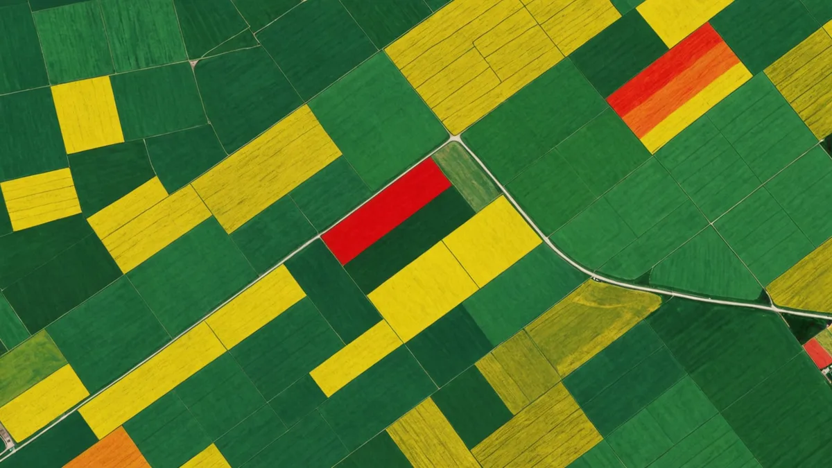
What bare-soil reflectance tells you before the crop is up
Bare-soil NDVI is a bit of a misnomer — NDVI was designed to index vegetation greenness, and on bare soil it returns low or slightly negative values that do not mean much by themselves. What the multispectral bands underlying NDVI do capture on bare soil is reflectance variation driven by soil organic matter, moisture content, and surface roughness. These signals are useful independent of the crop.
Bare-soil reflectance in the red and near-infrared bands correlates with organic matter content at field scale. Higher organic matter absorbs more radiation across the visible spectrum, making high-OM areas appear darker in satellite imagery. This spatial pattern is consistent from year to year because organic matter does not change quickly. A bare-soil image from mid-April, before planting and before significant residue decomposition has changed surface conditions, captures the underlying soil variability in a relatively stable state.
Comparing this year’s pre-plant bare-soil image to prior years in the same field lets you check whether the spatial pattern is consistent (it should be, mostly) or whether something has changed — new drainage areas, residue management changes, manure application zones that altered surface organic matter distribution. In Soilynx we keep bare-soil passes archived by field and flag when the current-year bare-soil pattern diverges meaningfully from the prior-year baseline, because a divergence that cannot be explained by known field management is worth investigating before the crop goes in.
Early-emergence NDVI and stand variability
The first satellite pass after emergence — when the seedlings are at VE to V1, with just the coleoptile or first leaf visible above ground — provides very low absolute NDVI values but high relative variability. A field with spatially consistent emergence will show a spatially consistent low-NDVI pattern with minor noise. A field with emergence problems — compaction-delayed areas, cold-wet low spots, seed placement issues on variable soil texture — will show lower-than-average NDVI values in specific zones that correlate with the problem.
The spatial footprint of emergence problems at this scale is often 3-10 acres, matching the scale of soil management zones. A zone where the clay lens is close to the surface in a depression holds cold water longer in early May, slows germination by 3-5 days versus adjacent better-drained zones, and shows up as a distinct lower-NDVI patch in the first emergence image. That same spatial footprint will show up again at V3, at tasseling, and in the yield map — but by the time it appears at tasseling you have no way to respond. At V1 or V2, you can walk the low spot, confirm whether it is a replant-eligible situation or a catch-up situation, and make an informed decision.
The catch here is image timing. An emergence image taken at V4 or V5, after canopy starts closing in denser plant populations, has already begun to saturate the NDVI signal in high-stand areas and loses some of the within-field contrast that makes early-emergence imagery useful. You want the image as early as possible after you can confirm the crop is in the ground and has had reasonable germination time.
Setting up monitoring reference points for the rest of the season
The agronomic value of early-season NDVI is not just the current-state snapshot — it is the reference point it establishes for interpreting every subsequent image. In-season NDVI monitoring is most useful when you can ask “has this zone changed relative to where it started?” rather than just “what is this zone’s NDVI value right now?”
A zone that emerged well but shows declining relative NDVI at V6-V8 compared to the early-emergence baseline is telling you something different than a zone that has always been lower in the field’s spatial pattern. The first pattern — good start, unexpected decline — is the one that warrants a scouting visit and possibly a corrective response. The second pattern may just reflect the permanent soil variability that the management zone map already accounts for.
We use the earliest clear-sky emergence image of the season as the “season zero” reference in our in-season monitoring layer. Every subsequent satellite pass is normalized against it — both as an absolute value and as a percentile rank within the field’s spatial distribution. This means the alerts we surface during the growing season are change-from-baseline alerts, not absolute-value alerts. A zone at NDVI 0.65 in July means nothing without context. A zone that ranked in the 80th percentile of the field at emergence and has dropped to the 35th percentile by V8 is a specific, actionable signal.
Cloud cover and the Iowa early-spring gap
The practical limitation on early-season NDVI in Iowa is cloud cover. May is a cloud-heavy month in the Midwest, and Sentinel-2’s 5-day nominal revisit quickly degrades to a 15-25 day effective clear-image interval when persistent cloud cover is factored in. Some years you will get one clear image before canopy closure that is useful for emergence assessment; other years you will not get anything until V4-V5, by which point much of the emergence signal is already washed out.
Planet Labs’ constellation (3-5 meter, daily revisit) can fill part of this gap in high-cloud years because with daily acquisition attempts you are more likely to capture a cloud gap. The trade-off is cost and the need for a different data pipeline than Sentinel-2 workflows. For most Midwest operations running Sentinel-2-based VRT programs, the practical answer is: archive every early-season clear pass automatically, even partial passes, and work with what you get. A pass that covers 60% of a field before the cloud band comes through is still useful for that 60%.
When early-season NDVI is not the right tool
We are not saying that early-season satellite imagery is diagnostic for all emergence problems. Compaction, crusting, wireworm pressure, seedling disease, and planter skips all look similar in a low-resolution satellite image — they produce a low-NDVI zone, and the satellite cannot tell you why the zone is low. The imagery is a trigger for field investigation, not a replacement for it. A grower who acts on an NDVI alert without walking the field to confirm the cause is using the tool incorrectly.
Fields with heavy cover crop residue at planting are also harder to interpret in early-season imagery. The satellite sees biomass regardless of species, and a thick cereal rye stand terminated a week before corn planting may still have enough residual green reflectance to mask the emergence signal from the young corn underneath. In those fields, the first usable emergence image may not arrive until the corn has grown through the residue mat enough to dominate the canopy signal — typically V2 to V3 on a well-terminated cereal rye stand.
The baseline principle still applies in those cases; it just requires waiting for the right imagery conditions. The point is to capture the first clean, crop-dominated image of the season, whatever timing that requires, and archive it as the season reference. Everything you do with satellite monitoring for the next four months is more interpretable when you have that starting point.