A soil carbon credit doesn't emerge from a spreadsheet or a management practice attestation. It starts with a tube of soil pushed into the earth at precisely recorded coordinates and ends with an entry in a registry's immutable transaction ledger. Every step in between — sample handling, lab analysis, spatial modeling, uncertainty quantification, documentation, and third-party verification — is a data handoff that must maintain chain-of-custody integrity to produce a credit package that survives buyer due diligence. This is what that process actually looks like.
Phase 1: Farm Enrollment and Pre-Sampling Assessment
The process begins before a core is pulled. At enrollment, Terrabit's field operations team conducts a pre-sampling assessment for each enrolled farm: field boundary verification against county FSA parcel data, soil mapping unit identification through USDA NRCS Web Soil Survey, NDVI time-series analysis from Sentinel-2 to identify within-field productivity zones, and HEL (Highly Erodible Land) designation review for additionality assessment purposes.
From this pre-sampling data, the sampling design is produced: field stratification into soil-mapping-unit-based zones, core location grid within each zone, required minimum core count to achieve ≤10% relative standard error at 90% confidence (calculated from expected CV using soil survey data), and GPS waypoints loaded to field collection devices. The sampling design document is archived as the first entry in the project's data package — it establishes the spatial framework that all future monitoring must follow.
Timing is scheduled to coincide with the optimal bare-soil satellite acquisition window: in central Iowa, this is typically October 15 through December 5, after corn/soybean harvest and before soil freeze, when NDVI is below 0.25 on bare fields and soil moisture conditions are generally declining toward the dry range needed for good spectral reflectance data quality.
Phase 2: Field Sampling Campaign
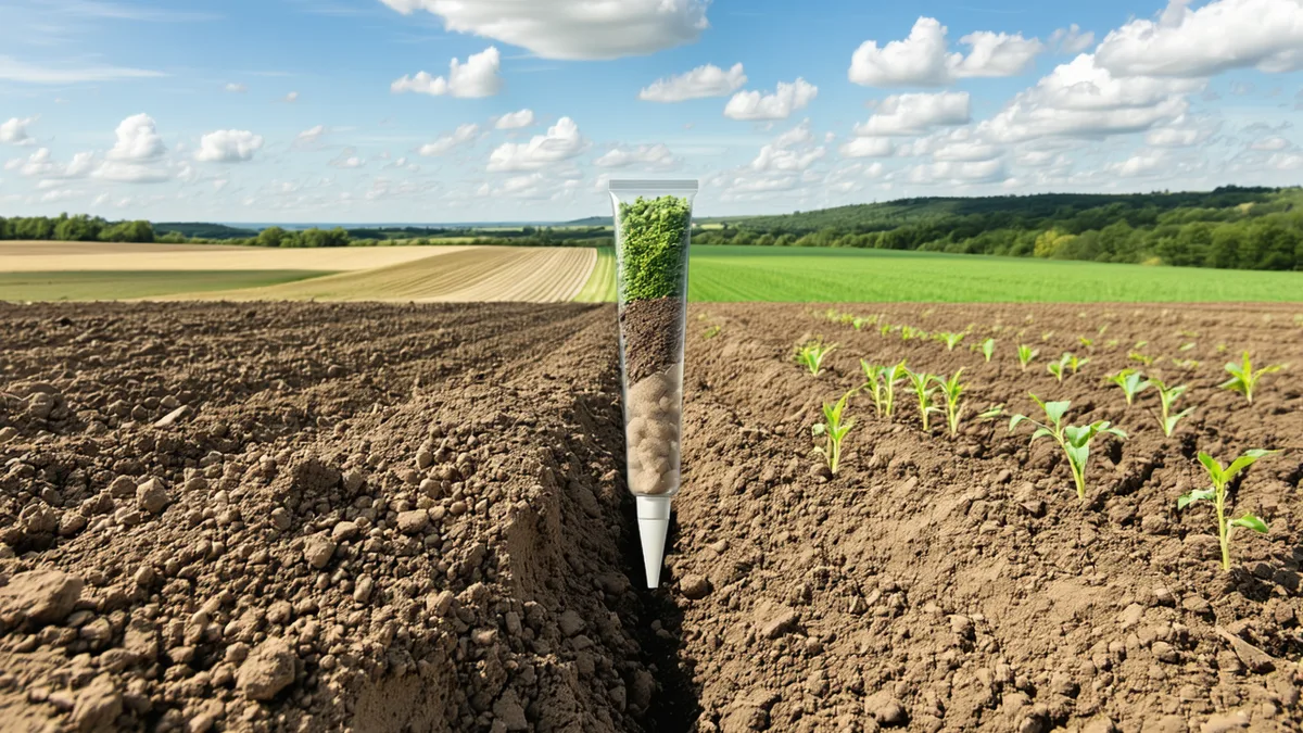
Field teams use GPS-guided core placement to the waypoints defined in the sampling design, with sub-meter positioning accuracy from a dual-frequency GNSS receiver. Core tubes (5 cm internal diameter, stainless steel) are driven to 90 cm depth using a hydraulic probe mounted on a side-by-side utility vehicle for flat ground or a hand-operated probe for tight access areas. Each core is extracted as an intact 90 cm column, photographed in situ alongside a field identifier and depth reference, and divided into three depth fractions: 0–30, 30–60, and 60–90 cm.
Bulk density is measured for each depth fraction by recording the exact core volume extracted (which requires confirming there was no compaction during extraction — a critical QC check that slower field teams sometimes skip) and will be completed by dry weight calculation after oven drying at the lab. Each fraction is placed in labeled, sealed sample bags with a unique sample ID that traces back to the field GPS location, collection date, and depth interval. The sample ID format follows a structured naming convention that makes the data chain unambiguous at every downstream step.
A field data sheet for each core records: GPS coordinates (decimal degrees, WGS84), collection timestamp, core tube ID, any deviation from planned protocol (e.g., compaction noted, rock fragment encountered, partial core due to gravel layer), and field operator signature. This sheet is photographed and uploaded to the project data platform before the field team leaves the farm. The physical samples are refrigerated within 4 hours of collection for transport to the analytical lab.
Phase 3: Laboratory Analysis
All soil samples are processed at a USDA-certified analytical lab. On receipt, samples are logged into the lab information management system (LIMS) against the field submission records, and a custody transfer form is signed. Samples are oven-dried at 105°C until constant mass (typically 48–72 hours for mineral soils), weighed for bulk density calculation, and then ground to less than 2 mm using a roller mill.
For subsurface samples from fields in soil series with known carbonate presence (some Typic Endoaquolls and Calciudolls in western Iowa counties can have secondary carbonate accumulation in the 60–90 cm horizon), a subset of samples is acid-treated with dilute HCl prior to SOC analysis to remove inorganic carbonate carbon. The decision to apply inorganic carbon correction is documented in the analytical request form; the correction factor and its uncertainty are reported in the lab results.
SOC concentration is measured by dry combustion using a LECO TruMac CN carbon analyzer (or equivalent) at 950°C in a pure oxygen atmosphere. Each run includes at least two certified reference materials at different SOC levels (LECO standard soil CRMs) and two instrument blanks for background correction. Duplicate analyses are performed on approximately 10% of samples, selected to span the SOC range in the batch. Results are reported as % dry weight SOC with analytical precision ±0.02% or better.
The lab report is delivered as a structured data file (CSV) with one row per sample ID, including: dry weight, field moisture content, bulk density (calculated), SOC concentration (dry combustion, carbonate-corrected where applicable), analytical duplicates, and QC sample results. This file is loaded directly into Terrabit's data platform, where it is joined against the field GPS data by sample ID.
Phase 4: Satellite Data Acquisition and Calibration
In parallel with the physical sampling campaign, the remote sensing workflow acquires Sentinel-2 Level-2A (bottom-of-atmosphere reflectance) tiles covering all enrolled farm boundaries for the sampling-season acquisition window. Cloud-filtered composites are built using the Scene Classification Layer (SCL) to exclude cloud, cloud shadow, and water pixels. Pixels with NDVI above 0.25 are masked as vegetated (not bare soil); pixels where the SWIR1/SWIR2 ratio exceeds a threshold indicating high crop residue fraction are flagged for residue correction treatment.
The bare-soil spectral composite — typically a temporal median of 3–7 cloud-free, bare-soil scenes across the October–December window — is extracted at each physical sample location using the GPS coordinates from the field data. This produces a matched dataset: lab-measured SOC vs. satellite reflectance values (specifically Bands 11 and 12 for SWIR1 and SWIR2, plus Band 8A NIR) for each sample location.
A partial least squares regression (PLSR) model is fitted to the calibration dataset, with leave-one-out cross-validation to assess predictive accuracy. The cross-validation RMSEP and R² are documented in the spectral model metadata. For farms where calibration RMSEP exceeds the 0.25% SOC threshold (indicating insufficient calibration quality), additional field samples are collected before the spectral model is applied to unsampled areas. The calibrated model is then applied to all bare-soil pixels within enrolled field boundaries to produce a spatially continuous SOC estimate map.
Phase 5: Verification Model and Uncertainty Quantification
The Terrabit verification model integrates the physical measurement points with the spatially continuous spectral estimate to produce the final field-level SOC estimate and its uncertainty characterization. The procedure follows a spatial kriging interpolation framework where physical samples provide the high-accuracy anchor points and the spectral model provides the spatial trend surface between them.
The combined estimate at each point in the field has a quantified uncertainty that reflects: (1) analytical measurement uncertainty from the lab (±0.02% SOC), (2) spatial sampling uncertainty from the sampling design (dependent on local kriging variance), and (3) spectral model uncertainty from the calibration RMSEP and the prediction interval at the specific spectral input value. These uncertainty components are propagated through the carbon stock calculation (multiplying SOC concentration by bulk density and depth) using Monte Carlo simulation (10,000 draws) to produce a probability distribution for the tCO₂e per hectare estimate.
The final field-level SOC stock estimate is reported as: mean ± 90% confidence interval. The reported credit quantity uses the lower bound of the 90% CI — a conservative reporting approach that means the stated credit quantity is one that the monitoring data supports with 95% probability of being less than or equal to the actual SOC change. This conservatism is required by Verra VCS VM0042 and provides a quantified margin of safety for buyers.
Phase 6: Project Documentation and Third-Party Verification
All data, models, and results are compiled into the monitoring report — a structured document following the VCS or applicable protocol template. For each enrolled farm, the monitoring report includes: field boundaries and soil mapping unit stratification, sampling design and core location documentation, chain-of-custody records from field to lab, lab analysis results with QC data, spectral model metadata and calibration results, uncertainty analysis outputs, additionality assessment documentation, and the calculated credit quantity with its uncertainty characterization.
The monitoring report is submitted to the engaged Validation/Verification Body (VVB) for third-party review. The VVB's verification process includes document review of the methodology compliance, data integrity checks (verifying that the data chain from field GPS to final credit quantity is traceable without gaps), and for first verification events, typically a site visit or video-documented field audit. The VVB issues a verification statement confirming that the monitoring report was conducted in compliance with the applicable methodology and that the claimed credit quantity is supported by the evidence.
Upon receipt of the verification statement, Terrabit submits the verified monitoring report to the registry (Verra, Gold Standard, or CAR as applicable) for credit issuance review. The registry logs the project monitoring event, records the buffer pool contribution deduction, and issues the net credit quantity as unique serialized carbon credits to the project developer's registry account. Each credit has a unique serial number traceable to the project, the monitoring period, and the verification event. These serial numbers are what a buyer receives in their portfolio — the end point of a chain that began with a soil core in a central Iowa field.
Written by the Terrabit Science Team. To understand how this process applies to your specific farm or to request a buyer data room package for a specific credit vintage, contact [email protected].