The credibility of a soil carbon credit is only as strong as the sampling campaign that produced the underlying measurement. Lab analysis can be performed correctly; the model can be well-calibrated; the documentation can be complete — but if the field sampling was conducted with a suboptimal design, the resulting SOC estimate carries irreducible uncertainty that no amount of downstream sophistication can correct. This article covers the field protocols that separate MRV-ready sampling from agronomically adequate but verification-inadequate sampling.
Understanding What You're Trying to Measure
Soil organic carbon is not uniformly distributed. Within a single field, SOC concentration varies with landscape position, drainage class, prior crop rotation history, organic matter input history, and the spatial distribution of microbial activity. In an Iowa cornfield, the difference in SOC between a well-drained knoll and a poorly-drained low-lying area in the same field commonly exceeds 1 percentage point — larger than the total sequestration that regenerative management might produce over several years.
This spatial heterogeneity is the central statistical challenge of soil carbon MRV. The objective of sampling design is not to eliminate that heterogeneity from the data — it's to characterize it well enough that the field-level SOC estimate has a quantified, bounded uncertainty. The Verra VCS methodology VM0042 requires that the sampling design produce estimates with documented precision at the 90% confidence interval level. The Gold Standard Soil Carbon Activity methodology has similar requirements. Reaching that precision bar requires a sampling design that accounts for the spatial structure of SOC in the specific field being measured.
Sampling Design: Grid vs. Stratified Random
Two sampling designs dominate MRV practice: systematic grid sampling and stratified random sampling. Each has tradeoffs that affect both statistical validity and operational cost.
Systematic grid sampling places cores at regular intervals across the field (e.g., one core per 10 acres on a regular grid). The advantage is simplicity and reproducibility — the same grid can be re-sampled at subsequent monitoring events with GPS precision, enabling direct temporal comparison at the same locations. The disadvantage is that a regular grid may systematically undersample or oversample certain landscape features if the grid spacing doesn't align with the scale of spatial variation.
Stratified random sampling divides the field into zones defined by soil mapping units (from USDA NRCS Web Soil Survey data), NDVI zones derived from satellite imagery, or topographic position derived from a digital elevation model, and places random cores within each zone. This approach tends to be more statistically efficient — it achieves lower variance in the field-level SOC estimate for the same number of cores — but requires the stratification layer to be reasonably well-correlated with actual SOC distribution, which should be verified for each field.
In practice, Terrabit's field teams use a hybrid approach: the field is pre-stratified using soil mapping unit boundaries and NDVI-derived zones, and cores within each zone are placed on a regular sub-grid. This provides both within-stratum spatial coverage and between-stratum representativeness, while enabling temporally consistent re-sampling at subsequent monitoring events.
Sampling Density Requirements
Minimum sampling density is a function of the field's spatial variability and the precision level required by the target protocol. As a practical lower bound, a single field or farm management zone enrolled in a Verra VCS project under VM0042 requires enough samples to achieve a relative standard error (RSE) of ≤10% in the SOC estimate at the 90% confidence level. The number of cores required to achieve this depends on the coefficient of variation (CV) of SOC in the field, which isn't known before sampling — a bootstrapping problem that most programs address by using conservative (high CV) assumptions in the initial sampling design.
For typical Iowa Mollisols with moderate spatial variability, field experience suggests 1 core per 15–25 acres is a reasonable starting density for initial baseline establishment. For fields with high landscape heterogeneity — significant slope variation, multiple soil series — 1 core per 10 acres may be necessary. Fields with very low spatial variability (flat, uniform, single soil mapping unit) may achieve the required precision at 1 core per 30 acres.
A 1,200-acre operation with moderate variability, for example, would require a minimum of approximately 48–80 soil cores for baseline establishment under these density guidelines. At typical field collection and lab analysis costs, that's a real operational expense — which is why the economic logic of aggregation (combining multiple farms into a single project to amortize overhead costs) is important for the economics of MRV-grade sampling at the individual farm level.
Depth Intervals and Core Handling
Standard depth intervals for agricultural soil carbon sampling are 0–30 cm, 30–60 cm, and 60–90 cm, following the IPCC soil carbon reporting convention for cropland. Some methodologies extend to 100 cm or beyond for deep-rooting systems, and some compress to 0–30 cm only for projects primarily targeting topsoil management interventions. The choice matters because the depth profile of SOC accumulation under regenerative management differs by practice: no-till primarily increases SOC in the 0–10 cm horizon; cover crops with deep taproots can add organic matter at 40–80 cm; perennial prairie restorations show SOC accumulation throughout the profile.
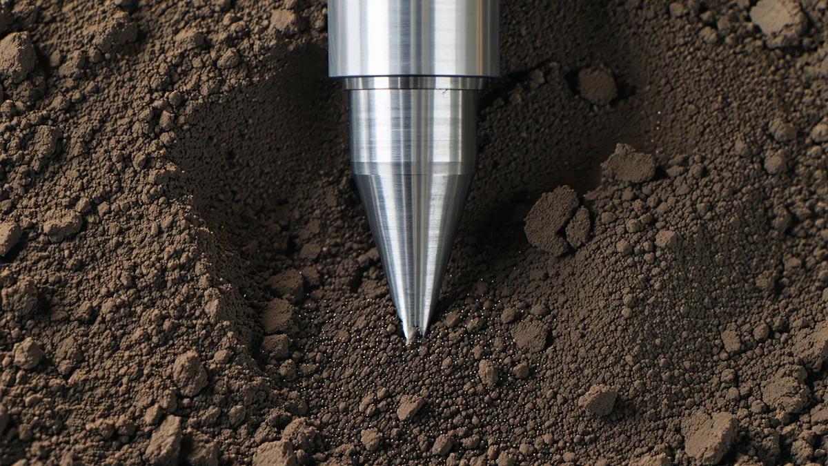
Core collection procedure is deceptively important. Key requirements:
- Consistent core diameter: typically 5 cm internal diameter, sufficient to capture representative soil volume while remaining manageable for field teams. Narrower cores increase the contribution of root fragments and macroaggregates to measurement variance.
- Composite vs. individual cores: Some protocols allow compositing multiple cores from within a single stratum before lab analysis. Compositing reduces lab costs but eliminates within-stratum spatial variance data that's useful for calibrating satellite models. Terrabit keeps individual cores uncompacted where the satellite calibration dataset requires individual sample GPS-matched reflectance data.
- Avoiding compaction: Core tubes must be driven into the soil without excessive force that would compress the core and produce artificially high bulk density readings. Compaction artifacts are a common source of systematic error in bulk density measurements, which directly propagate into the volumetric SOC estimate (SOC mass per area requires both SOC concentration and bulk density).
- Immediate field documentation: Each core should be photographed in situ, labeled with GPS coordinates and collection timestamp, and sealed in labeled sample bags before any splitting or sub-sampling.
We're not saying that simpler sampling designs are invalid. We're saying that the MRV context requires the sampling design to be chosen based on statistical requirements rather than operational convenience — and that those two things often produce different answers.
Bulk Density: The Often-Neglected Variable
Soil organic carbon is reported in two ways: as a mass fraction of dry soil (g C per 100 g dry soil, i.e., percent SOC) and as a mass per area (tC per hectare, which requires multiplying by bulk density and depth). Carbon credit quantities are reported in tCO₂e per hectare — a volumetric quantity that requires bulk density measurements to convert from the concentration-based lab output.
Bulk density in agricultural soils ranges from approximately 0.9–1.6 g/cm³, and it changes in response to tillage, compaction, and organic matter content. A soil with 2.5% SOC at bulk density 1.1 g/cm³ has significantly more carbon per hectare than the same soil with bulk density 1.3 g/cm³. Getting bulk density wrong — or assuming a literature value rather than measuring it — introduces a bias into the tCO₂e calculation that can be substantial.
Core-based bulk density measurement requires careful handling: the intact core volume must be precisely known, and the soil must be oven-dried completely before weighing. Many field teams underestimate the time required for complete drying, resulting in residual moisture being counted as soil mass and producing artificially high bulk density values.
Chain of Custody and Lab Selection
From the moment a soil core leaves the field, its chain of custody must be documented without gaps. Each sample container should have a unique ID, that ID should appear in field collection records with GPS coordinates and collection time, and the sample should travel directly to the lab under controlled temperature conditions (refrigeration if analysis will be delayed more than 48 hours; immediate drying if refrigeration isn't available).
Lab method selection matters for cross-sample comparability. Loss-on-ignition (LOI) is lower-cost but measures total organic matter; the conversion factor to organic carbon varies by soil type and introduces uncertainty. Dry combustion via elemental analysis (Dumas method, LECO or similar) directly measures total carbon; where soil carbonates are present (some western Midwest soils have secondary carbonates in subsurface horizons), inorganic carbon correction via acidification is required. Walkley-Black wet oxidation is historically common but is being phased out in favor of dry combustion due to lower precision and hazardous reagent requirements.
For MRV-grade analysis, Terrabit specifies dry combustion with carbonate correction on samples from fields in carbonate-bearing soil series. Lab selection should include labs with USDA-certified soil analysis programs or equivalent QA programs, and each batch of samples should include at least one certified reference material and replicate pairs for precision monitoring.
Re-Sampling for Temporal Monitoring
Baseline samples establish the reference SOC level; subsequent monitoring campaigns measure the change. The statistical power to detect a real SOC increase — distinguishing genuine sequestration from sampling noise — depends on sampling design consistency across time points. This means the monitoring campaign should re-sample as close to the original core locations as GPS precision allows, use the same depth intervals, same lab method, and same quality controls.
Paired sampling — returning to the same grid locations at each monitoring event — is statistically more powerful than independent random re-sampling, because the within-field spatial pattern of SOC is relatively stable over time. If the high-SOC areas are in the same locations at monitoring as at baseline, a paired design eliminates that spatial variance component from the change estimate, substantially reducing the number of cores needed to achieve a given detection power.
The practical implication: invest in accurate GPS coordinates at baseline. A handheld GPS with sub-meter accuracy is sufficient; centimeter-level RTK GPS provides additional precision that's rarely operationally necessary for MRV purposes, though it's useful for satellite model calibration where core-to-pixel alignment matters.
Written by the Terrabit Science Team. For specific sampling protocol questions for your operation, contact [email protected].