A soil moisture sensor gives you a reading at a point. Your field is not a point. The gap between those two facts is where sensor placement strategy either earns its cost or doesn't. We've seen farms spend $3,000 or more on sensor hardware and end up with data that tells them nothing actionable about the rest of the field — because the sensor went in at the wrong spot.
This guide is specifically about variable-soil fields: those where the coefficient of variation in soil texture, organic matter, or water-holding capacity across the field is high enough that a single sensor location represents, at best, one part of the field. If your field is largely uniform in soil type, this is less critical. But if you're farming across multiple soil series — which describes the majority of Iowa row crop ground — placement strategy matters a great deal.
What You're Actually Trying to Measure
Before picking a spot, be clear about the question your sensors need to answer. There are two fundamentally different use cases, and they require different placement logic.
The first use case is irrigation scheduling or deficit irrigation management — understanding when and where the crop is approaching or exceeding a threshold volumetric water content (VWC) that will cause stress. For this use case, you want sensors in the zone that depletes moisture fastest, because that's the location that will trigger an irrigation decision. Placing in a high-water-holding-capacity soil will cause you to systematically under-irrigate the sandier zones.
The second use case is prescription calibration — using in-ground VWC readings to understand the relationship between soil type, position in the field, and moisture dynamics so you can build better zone-specific models. For this use case, you want sensors in multiple representative zones, not just the most stress-prone one.
In the variable-rate prescription context we work in at Soilynx, the second use case is primary. We're using sensor data to validate and refine zone boundaries and to understand how different soil types in the field respond to rainfall and dry-down events — not to trigger irrigation decisions on dryland corn.
Using the EC Map and Soil Series to Define Zone Representatives
The starting point for sensor placement is the field's electromagnetic induction (soil EC) map, if one exists, combined with the SSURGO soil series data available from the USDA Web Soil Survey. These two layers together define the soil variability structure of the field.
On a 480-acre field in Washington County, Iowa, we worked with an operator whose EC map showed three distinct zones: a high-EC zone (above 35 mS/m) in the bottomland Coppock and Kalona silty clay loams; a mid-range zone (20–35 mS/m) in the Mahaska and Taintor soils on the bench; and a low-EC zone (below 18 mS/m) on the ridgetop Ladoga and Lindley loams that had significant surface erosion. Each zone has a meaningfully different water-holding capacity: the Kalona silty clay loam holds field capacity moisture to around 0.36–0.40 cm³/cm³, while the Lindley loam on the eroded knoll holds field capacity at roughly 0.22–0.27 cm³/cm³.
In a field like that, a single sensor anywhere tells you the story of one soil type. You need at minimum two sensors — one in the high-water-holding bottomland zone and one in the most stress-prone low-EC ridgetop position — to have enough information to characterize the field's actual moisture dynamics across its variability range.
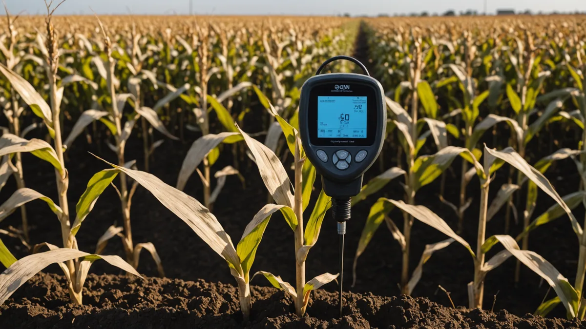
Depth Placement: The Overlooked Dimension
Horizontal location gets most of the attention in sensor placement discussions, but depth placement is equally important and often handled poorly. For Meter Group TEROS 12 sensors and Campbell Scientific CS655 probes — the hardware we most commonly see in Iowa dryland corn applications — the standard installation protocol places sensors at two to three depths: typically 6 inches, 18 inches, and 36 inches.
The 6-inch depth captures the active root zone where most corn water uptake occurs in early season; the 18-inch depth tracks the mid-season root zone deepening through V8–VT; and the 36-inch probe detects deep drainage and tells you whether water applied or received is moving below the effective root zone.
In shallow, eroded soils like the Lindley loam example above, a 36-inch installation may hit the B2 or C horizon — which changes the interpretation of the reading. Always confirm effective soil depth at the sensor location before specifying installation depth. A soil probe push ahead of sensor installation costs five minutes and prevents a year of misinterpreted data.
Avoiding Common Placement Errors
The three placement errors we see repeatedly:
Placing at the edge of the field near the access road. Convenience is a real consideration — sensors need site visits for maintenance and data download in systems without cellular telemetry — but field edge soils are often not representative of the field interior. Tillage headland compaction, border effects from adjacent non-crop areas, and windbreak shadow effects all make field edges poor representatives of the management unit you're actually trying to characterize. Try to place sensors at least 150 feet from any field boundary.
Placing in the highest-performing zone and using those readings as the field standard. High-productivity ground in Iowa — Tama or Muscatine soils with 3.5%+ OM, level to gently sloping — holds moisture well and is rarely the location where management decisions need to be driven by soil moisture data. Placing sensors only in your best ground gives you readings that are typically fine, and you never see the stress signal that's developing in the drier zones.
Not accounting for preferential flow paths. In fields with tile drainage or macropore-dense soils (common in some Iowa soils with significant earthworm activity or old root channels), a sensor installed directly above a tile line or in a known preferential flow path will drain much faster than surrounding soil after a rain event. This creates an apparent dry-down signal that doesn't represent the water-holding behavior of the bulk soil. Check your tile drainage maps before installation and keep sensors at least 10 feet from a known tile lateral.
How Many Sensors Per Field
The answer depends on field variability, not field size. A 200-acre field with three distinct soil types in roughly equal proportion needs at least three sensor clusters. A 600-acre field with low soil variability and a single dominant soil series might be adequately characterized by two clusters placed at representative landscape positions.
The general framework we use: identify the number of distinct management zones in the field using the EC map and SSURGO data. Each zone that covers more than 15% of the field area and has meaningfully different water-holding capacity characteristics warrants its own sensor cluster. A zone covering less than 10% of the field area may not justify dedicated hardware, but its behavior should be understood through periodic manual soil sampling at the start and end of critical growth periods.
We're not suggesting every Iowa corn grower needs a sensor network. On a dryland corn operation with a single soil type and consistent year-over-year yield stability, in-field sensors add cost with limited return. The value is highest in fields where yield variability tracks soil moisture variability — and those fields are identifiable from historical yield monitor data and NDVI history before you spend a dollar on hardware.
Integrating Sensor Data with the Soilynx Zone Model
Once sensors are installed and generating VWC data, the readings feed into our zone calibration layer rather than directly into prescription outputs. What we're looking for is the dry-down rate differential between zones: how quickly does the low-EC ridgetop position lose moisture relative to the high-EC bottomland after a rainfall event? That differential, tracked across several rain events and dry periods, gives us a field-specific calibration coefficient that improves the accuracy of satellite-derived stress predictions for that field in future growing seasons.
In other words, the sensor data in year one makes our satellite analysis more accurate for that field in years two and three. The payoff compounds. A producer who installs sensors and gives us a full season of data across their soil zones is giving us the field-level calibration that makes NDVI-based prescription decisions significantly more reliable over time — which is the actual objective.