The soil carbon MRV technology landscape in 2025 looks substantially different from where it was in 2020, when most programs were using IPCC Tier 1 emission factors and spreadsheet-based reporting. Direct measurement has become more practical, satellite data products have matured, and biogeochemical models have been updated with better parameterization for US Midwest conditions. But each approach still has a different cost structure, accuracy profile, scalability ceiling, and protocol acceptance status — and choosing the right combination for a specific project context requires understanding the tradeoffs honestly.
The Three Approaches and What They're Actually Measuring
Direct Soil Sampling (Ground Truth)
Physical soil core sampling with laboratory analysis is the only approach that directly measures SOC. Everything else infers it. Loss-on-ignition (LOI), Walkley-Black wet oxidation, and dry combustion via elemental analysis (LECO, Costech, or similar instruments) each produce a mass-fraction SOC reading from an actual soil sample. Dry combustion is the current methodological standard for MRV-grade applications — lower bias, higher reproducibility, and free of the hazardous reagent handling challenges of Walkley-Black. LOI remains widely used but requires soil-type-specific conversion factors that introduce uncertainty.
The accuracy ceiling for direct sampling is set by sampling design rather than analytical method. A well-designed stratified random sampling campaign with adequate core density achieves ±0.1–0.2% absolute SOC in the field-level estimate at the 90% confidence level. The limiting factor is spatial variability within the field, not lab precision — modern elemental analyzers have reproducibility of ±0.02% SOC or better, but that precision doesn't help if sampling only captures 40 of the 80 cores needed to characterize a high-variability field adequately.
Cost: The highest cost per area of all approaches. Field collection costs depend on access and core depth, but at typical labor and logistics rates, physical sampling in Iowa runs in ranges that make whole-farm direct measurement cost-prohibitive for large operations without aggregation economics. The lab analysis cost for dry combustion is generally the smaller component of total sampling cost on a per-sample basis.
Protocol acceptance: Universal. All major protocols (VCS VM0042, Gold Standard, CAR SEP, IPCC Tier 3) accept direct measurement as the highest-quality input. No protocol-acceptance risk for well-documented physical sampling campaigns.
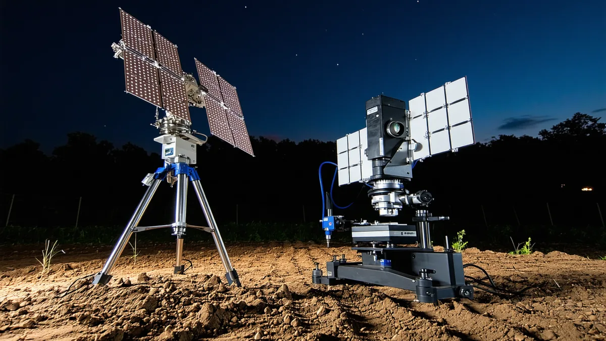
Remote Sensing (Satellite Spectroscopy)
Satellite-based approaches infer SOC from spectral reflectance patterns in bare-soil imagery. The scientific basis — SWIR reflectance inverse correlation with SOC — is robust for mineral agricultural soils under appropriate conditions. The operational challenges (soil moisture confounding, crop residue interference, atmospheric correction requirements, and the fundamental surface-only sensing depth) are well-characterized and manageable with proper pre-processing protocols.
Sentinel-2 (ESA/Copernicus) and Landsat 9 (USGS/NASA) are the primary platforms for agricultural-scale MRV applications. Both are free-access, which is an important practical and auditability advantage over commercial hyperspectral platforms. Commercial hyperspectral sensors (AVIRIS-NG, Hyspex, airborne hyperspectral platforms) offer more spectral bands and better spatial resolution, but at significantly higher per-acquisition cost and with less frequent revisit cycles that are incompatible with continuous monitoring.
Accuracy without ground calibration: Poor to moderate. An uncalibrated spectral SOC model applied to a novel field can produce estimates with errors of ±0.5–1.5% absolute SOC — wider than the expected signal from 2–3 years of regenerative management. This makes stand-alone satellite SOC estimation insufficient for credit-grade measurement.
Accuracy with field-calibrated model: Good to very good. When calibrated against 30–100 physical cores from the target field, farm-specific spectral models routinely achieve RMSEP values of 0.15–0.25% SOC in cross-validation on Iowa Mollisols, which is sufficient for detecting the changes expected from regenerative management transitions over 2–5 year periods.
Cost: Low marginal cost for imagery (free), moderate cost for model development and calibration (primarily analyst time), and enabling very low cost for ongoing monitoring once calibrated. The satellite approach allows spatial interpolation across entire enrolled areas from a relatively small physical sample set, which is where the economic leverage comes from.
Protocol acceptance: Accepted as a complementary monitoring approach under VCS VM0042 and CAR SEP when calibrated against physical samples. Not currently accepted as a standalone baseline measurement tool by any major protocol — physical baseline measurement is still required before satellite monitoring can substitute for physical re-sampling between monitoring events.
Biogeochemical Model-Based Estimation
Biogeochemical models — RothC, CENTURY/DayCent, and their successors — simulate SOC dynamics based on climate inputs, soil texture data, organic matter inputs, and management practice parameters. They don't require physical measurement after the initial parameterization; they project SOC changes from model inputs. This is both their appeal (very low marginal cost per additional enrolled acre) and their methodological limitation (the model's accuracy is bounded by how well its parameterization represents the actual field conditions).
IPCC Tier 1 and Tier 2 approaches are essentially simplified biogeochemical models using national or regional-average parameterization. Tier 1 default factors are defined at the global scale — mean values across entire climate zones and soil types. Applied to a specific Iowa Mollisol field, they carry inherent uncertainty that can range from ±30% to ±60% of the estimated SOC change.
More sophisticated dynamic process models (DayCent, DNDC) can be parameterized with field-specific soil texture, drainage class, climate records, and crop management data, and achieve substantially lower uncertainty than Tier 1. Under VCS VM0042, the Quantification of GHG Emissions from Feedlot Cattle using DNDC is an example of protocol-accepted model-based quantification. For cropland SOC, approved dynamic models include DNDC and CENTURY within specified parameterization and uncertainty assessment requirements.
Cost: Low per-acre cost at scale once the model is calibrated and parameterized. High upfront investment for proper model setup, data acquisition (soil texture, drainage, historical management records), and uncertainty analysis. Model validation against actual field data should be a requirement but is not always performed rigorously.
Protocol acceptance: Accepted under VCS VM0042 for IPCC-approved dynamic models with documented uncertainty assessment. Not accepted as a substitute for direct baseline measurement in most protocols. Ongoing monitoring can use model projections in some protocol variants, subject to periodic verification sampling to confirm model predictions.
We're not saying model-based approaches are fraudulent. We're saying the uncertainty range on a model-estimated SOC change is genuinely wider than on a well-designed direct measurement campaign, and that difference has real implications for how much of a credit vintage a buyer can rely on with confidence.
The Proximal Sensing Category (Near-Term Relevant)
Ground-based spectral sensors — vis-NIR hand probes, benchtop spectrometers for field-collected samples, and portable LIBS (laser-induced breakdown spectroscopy) devices — offer a middle path between satellite spectroscopy and traditional lab analysis. These devices can measure SOC at the point of sample collection with varying accuracy, reducing the time-to-result and potentially reducing the need to ship samples to a centralized lab.
Portable vis-NIR spectrometers with field-specific calibration models can achieve accuracy comparable to LOI (and somewhat below dry combustion) on soils where the spectral database has good coverage of the target soil type. For Midwest Mollisols, commercial and open-source spectral libraries (KSSL/NSSC) have reasonable coverage, but model performance degrades on samples outside the training distribution — particularly high-SOC peaty soils or soils with unusual mineralogy.
The protocol acceptance picture for proximal sensing is evolving. The Soil Carbon Initiative methodology updates under development as of 2025 are expected to provide clearer guidance on vis-NIR acceptance, but as of now, proximal sensing results generally require validation against dry combustion lab analysis to be accepted in final verification submissions. Proximal sensing is most useful for increasing sampling density during field campaigns while reserving a subset for full lab analysis — a hybrid approach that captures spatial coverage while maintaining protocol-grade accuracy at the required statistical precision level.
Eddy Covariance: The Whole-Ecosystem Reference
Eddy covariance towers measure the net CO₂ flux between a land surface and the atmosphere at the ecosystem level, integrating over a footprint of typically 0.1–1 km² depending on tower height and atmospheric conditions. This is a genuinely direct measurement of net ecosystem carbon exchange, but it measures net flux (photosynthesis minus respiration plus soil CO₂ efflux) rather than SOC stock change — and the two are related but not equivalent for carbon accounting purposes.
Eddy covariance installations are capital-intensive (significant upfront instrument cost plus ongoing maintenance and data processing), require specialized expertise, and have a footprint scale that makes them better suited to landscape-level research than to farm-level MRV for credit issuance. Their primary relevance in the MRV context is as validation reference data for model-based approaches and satellite products — comparing modeled or remotely-sensed carbon flux estimates against tower data helps identify systematic biases in those methods.
Choosing the Right Combination
For MRV-grade soil carbon projects in 2025, the methodologically sound approach is a hybrid: physical soil core sampling for baseline establishment and periodic direct verification, paired with satellite spectroscopy for continuous monitoring and spatial interpolation between sampling campaigns. Biogeochemical models are useful for projecting expected change trajectories and flagging anomalies in the measured data, but should not be the primary quantification tool for credit issuance.
The cost-effectiveness argument for the hybrid approach is straightforward: satellite monitoring eliminates the need for annual whole-farm physical re-sampling, reducing ongoing monitoring costs by approximately 60–75% compared to full annual direct sampling while maintaining equivalent statistical precision in the annual SOC change estimate. The physical baseline and periodic (typically biennial) direct sampling campaigns anchor the spectral model and provide the registry-acceptable direct measurement record that protocols require.
Written by the Terrabit Science Team. For methodology comparison discussions specific to your project context, contact [email protected].